A new look at an old basin
The scrubby terrain and vast sky of the survey site on Nyikina and Mangala country Image: Helen Debenham
The echoes of vibrating trucks, earthquakes and the crashing of waves on the beach are some of the seismic waves that will be picked up by AuScope’s newly acquired sensors. Our Earth Imaging & Sounding team, along with industry and academia are testing their deployment during an NCRIS enabled survey that aims to discover, in greater detail, the hidden depths of the Canning Basin.
Capturing new data
It is exciting to be on the edge of capturing something new — to see further and with more clarity than before. The new three-component nodes will explore how fluids and rocks interact in the Canning Basin and help researchers understand how it formed. This NCRIS supported project is bringing together the expertise of Buru Energy, Terrex Seismic, ANU and GSWA to test these new nodes and gather seismic data.
Traditional survey — vibrating trucks
The team will be combining traditional survey techniques with the new nodes. Traditional surveys, with a single sensor (geophone), can only measure vertical ground motion, the up and down of a wave. The new sensors will be capturing seismic waves from both passive sources such as earthquakes, and active sources generated by vibrating trucks (vibroseis). The resulting data will tell the team about the underlying geology.
A cluster test of 3C nodes deployed in the red soil of the Canning Basin. Image: Helen Debenham
Looking in new directions
The new nodes with three sensors are able to measure ground motion in three directions - vertical, North-South and East-West. The nodes capture new information on how the ground is moving and more types of waves. In particular, the horizontal side to side motion of S waves is captured by the N-S and E-W geophones.
The nodes will be left out for an extended period of time, recording both earthquakes and ambient seismic noise such as waves crashing along the coast of W.A and S.A. This timeline differs from traditional surveys that remove sensors very quickly, often once vibroseis is over.
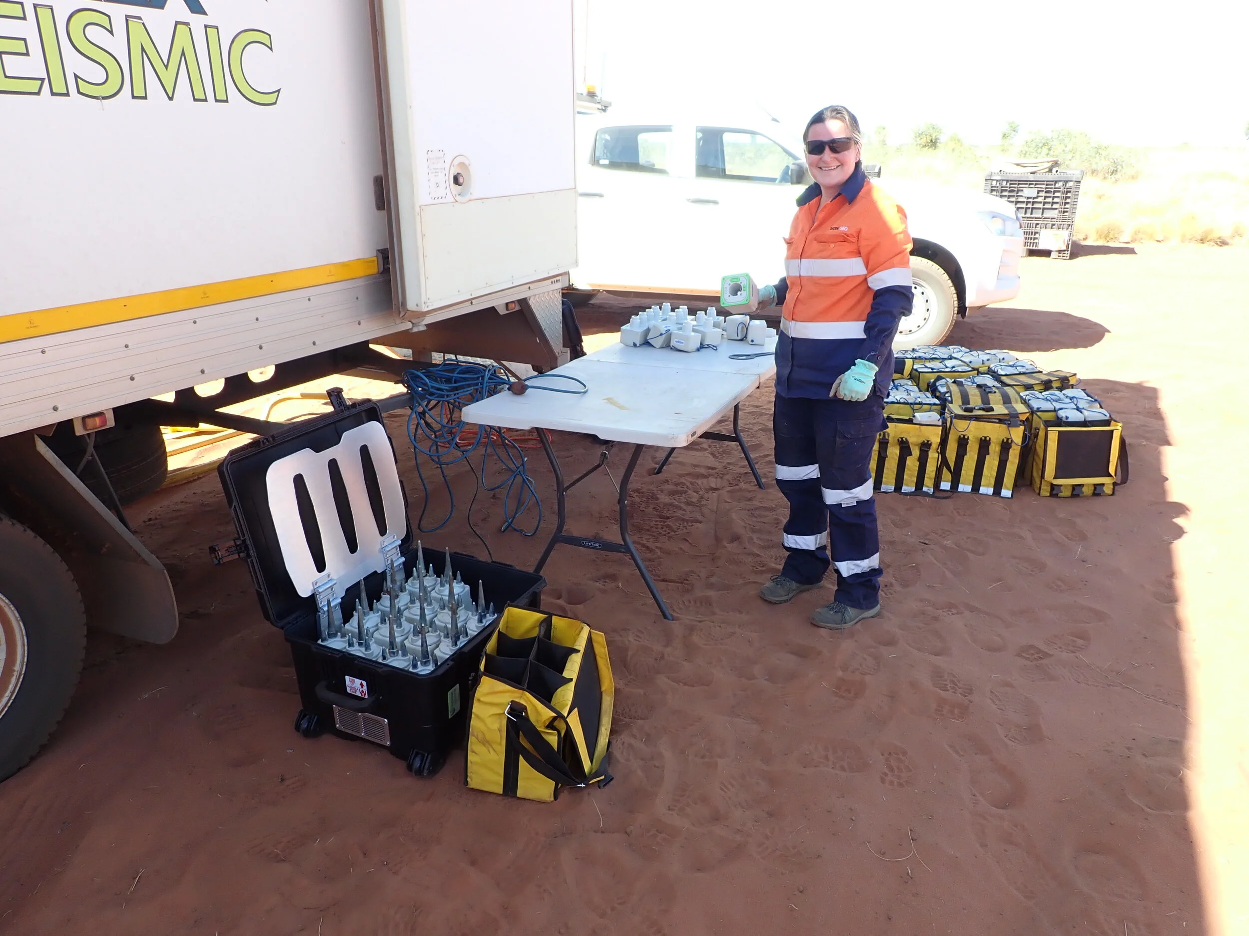
An excited Helen Debenham (Buru Energy) preparing the nodes for deployment. Image: Helen Debenham
Survey outcomes
Capturing both ambient seismic noise and vibriosis gives the researchers more data. In addition, the three-component sensors pick up in greater detail the way seismic waves move through different rock types. This detailed and varied seismic data will help generate 3-D seismic images of the basin and indicate deeper structures below that have helped form the basin.
The academic research team will have access to data that is often only available in limited formats after long exclusion periods. Lead investigator Dr Chengxin Jiang at ANU reflects on the survey:
“This project is the first of its kind in Australia by leveraging the multi-component seismic nodes for multi-dimensional active and passive seismic data collection. This unique treasure trove of data will drive innovative technical developments to allow basin imaging in unprecedented resolution.”
Chengxin notes that this will thus encourage stronger collaborations between industry and academic communities in Australia. The collected data will be made available to researchers through the AusPass portal. Chengxin notes that this new data will draw extensive attention from the seismic community across the globe and further foster international collaboration:
“This will put Australia, including its industrial and academic components, at the forefront of the relevant research fields globally.”
AUTHORS
Dr Michelle Salmon and
Philomena Manifold
Edited by Jo Condon
KEY CONTACT Dr Michelle Salmon, ANSIR Seismic Equipment Scientific Coordinator
FIND OUT MORE
AusPass portal
We are open to collaborative partnerships, please reach out if you have any exciting new project partnership in mind


